Topographic Mapping
Generation of precise topographic maps and digital elevation models (DEMs) for engineering and planning purposes.
Service Details
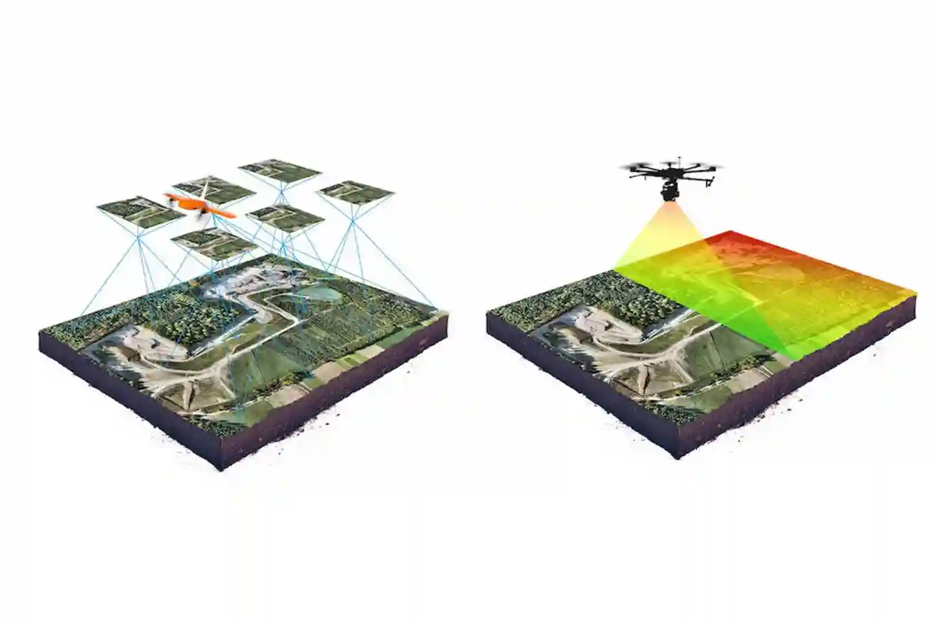
We provide UAV-based topographic surveys using photogrammetric processing to generate:
-
Digital Elevation Models (DEM / DSM)
-
Contour lines
-
Dense point clouds
-
High-accuracy survey maps
These outputs support engineering design, infrastructure planning, and cut-and-fill volume calculations.
Related Services

Drone-Based Building Cleaning
Facade and high-rise cleaning using tethered drone systems for safe and continuous operations.
Learn More
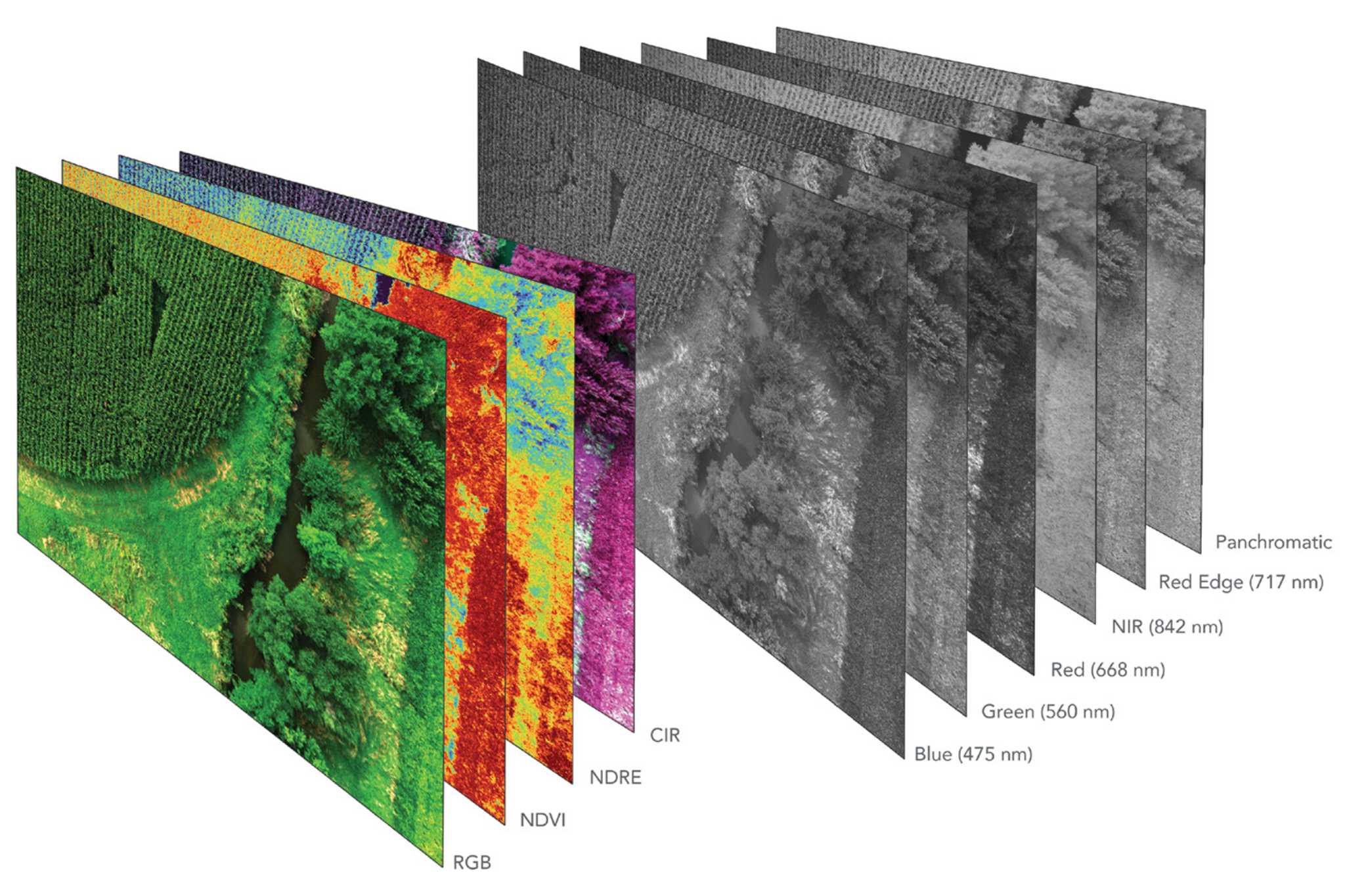
Multi & Hyperspectral Surveys
Spectral analysis of reflected light to assess vegetation health, environmental conditions, and subt...
Learn More
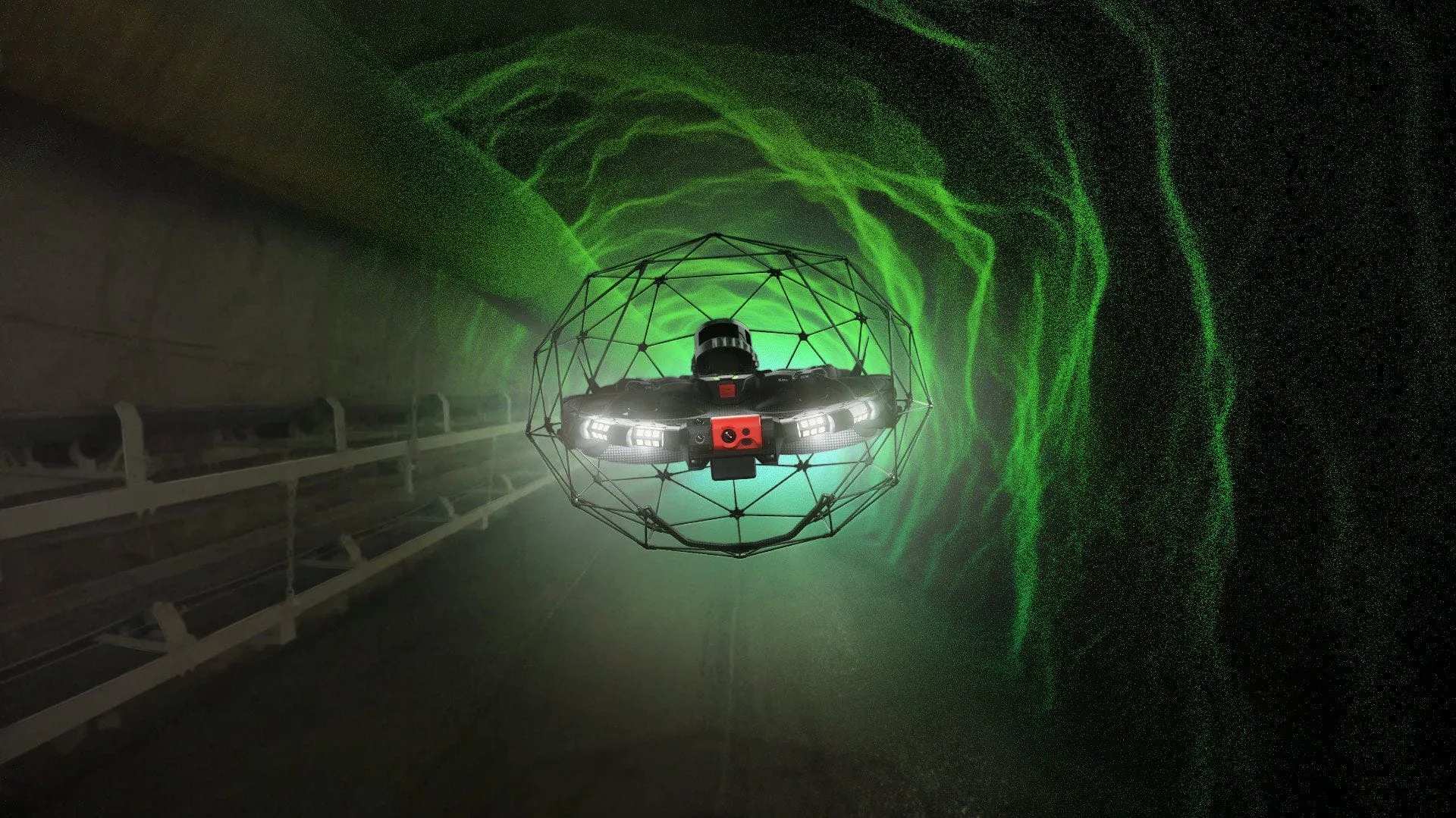
Confined Spaces Inspections
Inspection of tanks, tunnels, and enclosed industrial assets without human entry.
Learn More